Cyrus Chu
WGS84 · UTM 50N 22.3193° N / 114.1694° E
Scroll
GEOSPATIAL INTELLIGENCE // HONG KONG SAR

Cyrus Chu.

A one-person lab in Hong Kong turning geospatial intelligence into working AI agents. Enterprise GIS by day; agents and digital twins after hours.

Base Hong Kong SAR
Focus Geospatial Intelligence
Scale Solo · Scalable
01 / ABOUT

A small lab,
not a big company.

A passionate geospatial professional exploring what agentic AI can do with spatial data — building agents, digital twins, and machines that see the world spatially. One-person lab, big curiosity, and a lot of momentum. Holding a BSSc (Hons) in Geography, with advanced GIS training in Canada — now putting enterprise GIS and spatial data to work in Hong Kong.

Cyrus Chu — Independent Geospatial Intelligence · Agent-as-a-Service Founded by one person
02 / CAPABILITIES

What I build.

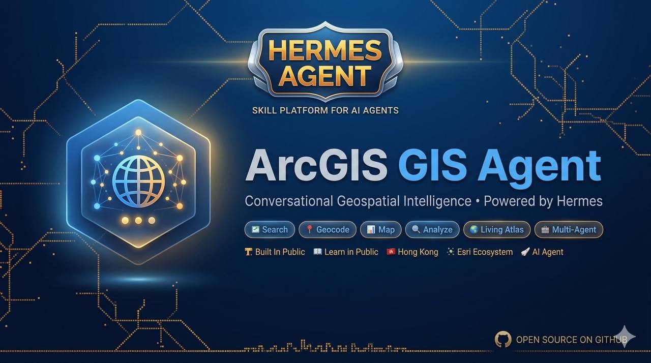
Hermes agent stack — ArcGIS GIS Agent Hermes agent stack · ArcGIS GIS Agent

Geospatial Agent as a Service

Tailor-made agents for your business logic and workflows — data engineering, sales & outbound, back-office admin and operations. Built around how you actually work.

Deploy
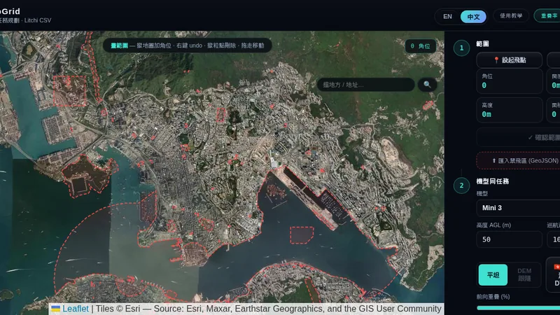
Drainage Network Assistant · agent demo

Agentic Application Development

Custom applications built around AI agents — interfaces, APIs, and workflows that turn agent power into a product your team actually uses.

Build
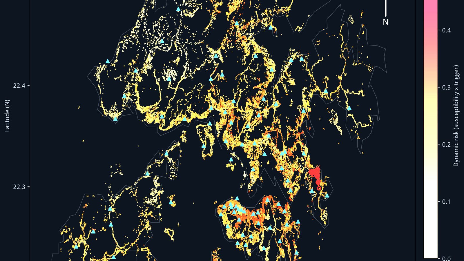
Hong Kong slope risk model map Slope risk model · Hong Kong

Machine Learning &
Deep Learning

Processing services for imagery, point clouds, and spatial data — trained and run on cloud GPUs when the job demands real compute.

Compute
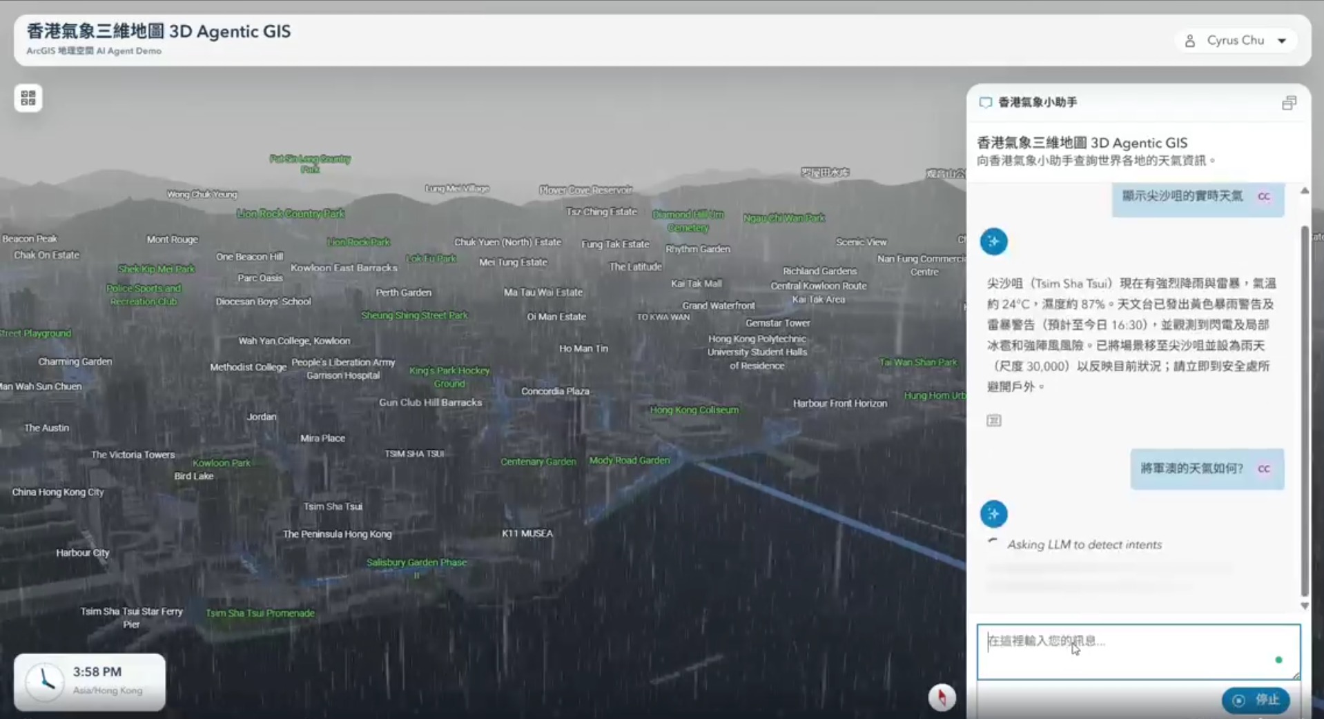
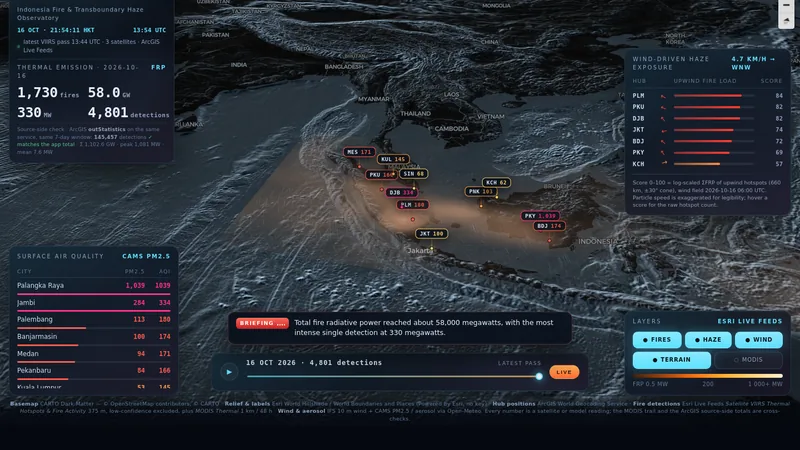
3D Agentic GIS — Hong Kong weather agent 3D Agentic GIS · HK weather agent

Location Intelligence

Living digital twins with IoT integration, real-time dashboards, and 3D mapping — places that think, not just pictures of places.

Live
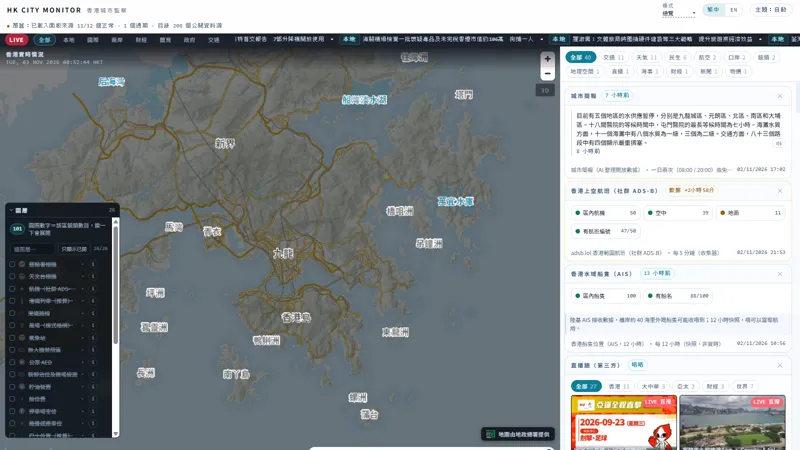
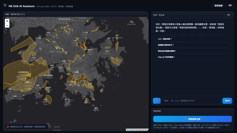
03 / PROJECTS

Live and public.

04 / AGENT SERVICES

Why agents,
why me?

Anyone can use AI to do something — vibe coding, automation. But domain knowledge and infrastructure take time to accumulate and set up. That's the part I bring.

Geospatial-native,
not generic

Most agents are trained to be helpful. Mine are trained to be spatial — coordinate systems, data pipelines, analysis. It arrives knowing your domain, not learning it from your prompts.

GIS native

Enterprise-grade infrastructure

Always-on, secure cloud infrastructure — and top-tier GPU on demand when the job needs real compute. Your data stays protected, your agents stay up.

Secure · Scalable

A human in the loop

Every engagement starts with a consultation — we figure out what you actually need before any agent is built. Then I keep watching it. Not a dashboard with nobody on call.

Consultation-first

Not sure where an agent fits? Start with a free consultation.

06 / STORY

Beyond
the screen.

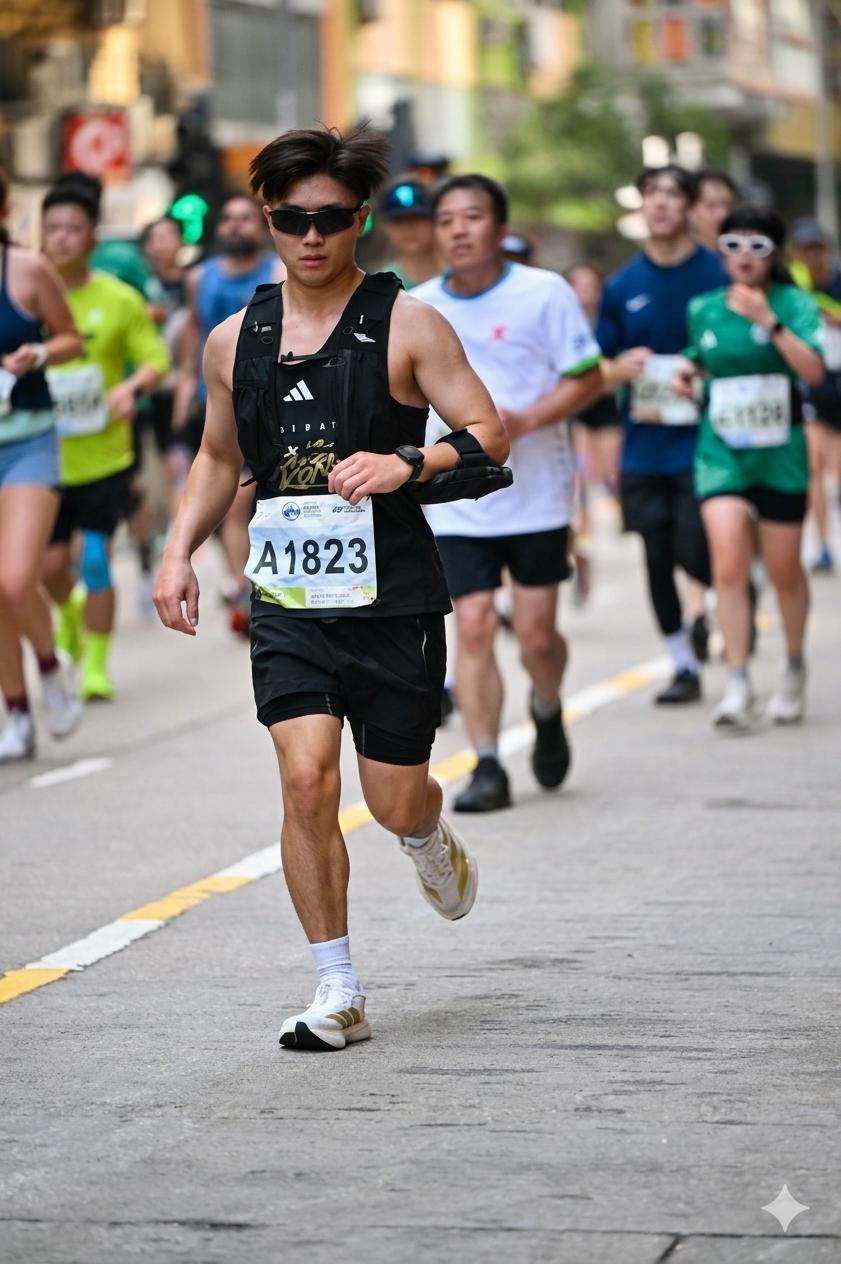
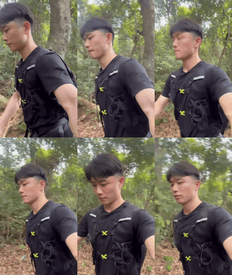
Away from the screen, I love to move — currently training toward my first ultramarathon (100 km), with marathon miles and HYROX behind me, and trail running whenever the city runs out. The same discipline carries into my work — show up, do the reps, measure the progress.

SHOW UP. DO THE REPS. MEASURE THE PROGRESS.
42.195
km — Marathon
HYROX
Open Single — Finished
100 km
Ultramarathon — in training
∞
Curiosity — never mapped
Cyrus running the Hong Kong marathon
Marathon — Finish line 42.195 km · done
Cyrus at HYROX — sandbag lunges
HYROX — Open Single 8 km · 8 stations · finished
Trail running — training for a 100 km ultra
Trail Running — training 100 km ultra · in progress
07 / TRADITIONAL GIS

Classic GIS work.

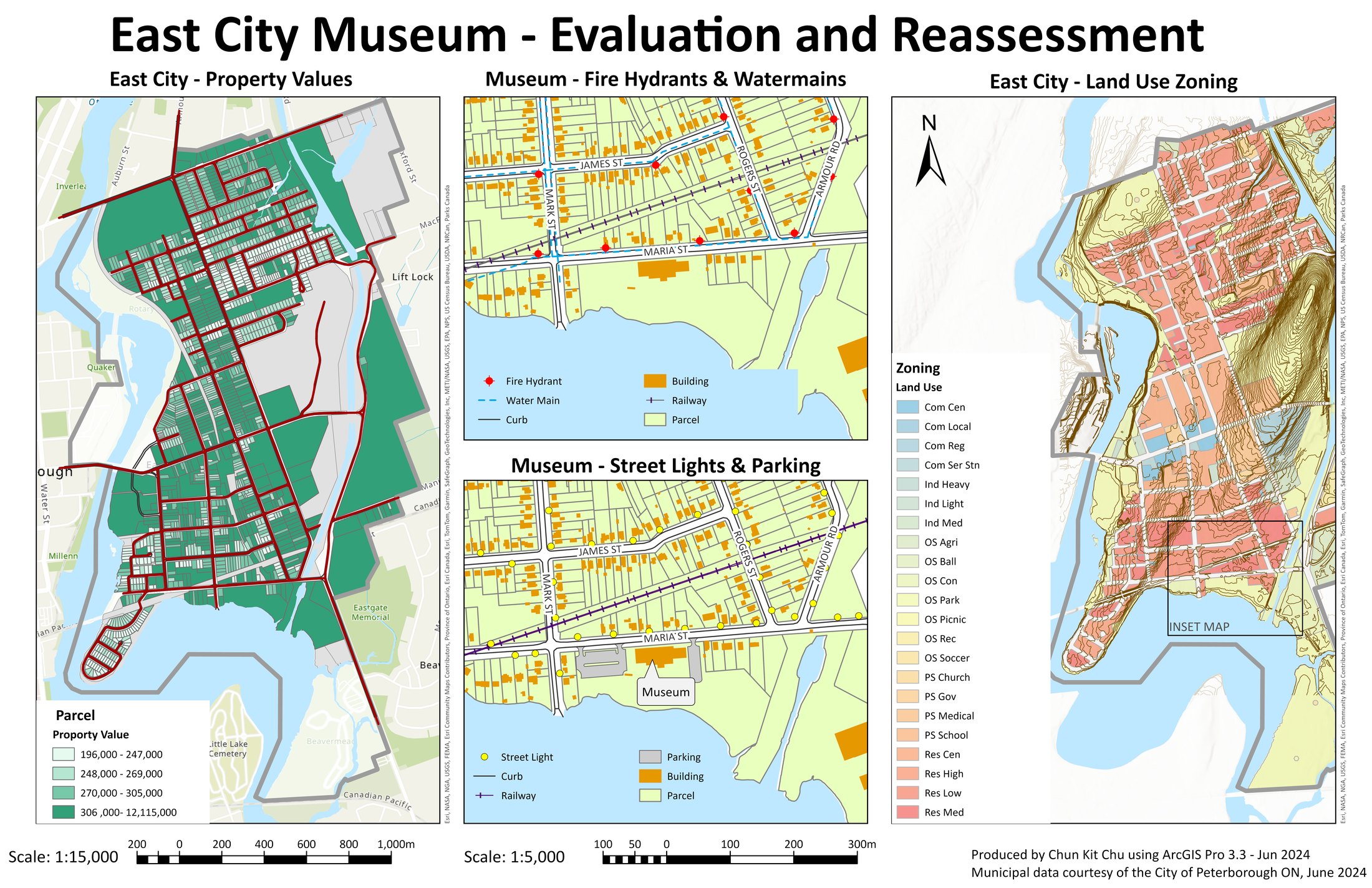
East City Museum — multi-panel ArcGIS Pro map layout East City Museum · ArcGIS Pro

Map Production

Cartographic craft — layout, hierarchy, legend design.

Canada Wildfires · 3D

Visualization

2D / 3D maps, dashboards, and interactive scenes.

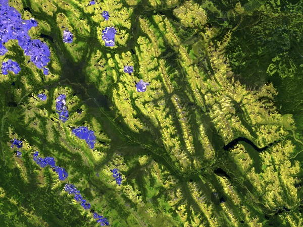
Banff National Park — Sentinel-2 NDVI colorized Banff · Sentinel-2 NDVI

Remote Sensing

Satellite imagery, orthophotos, spectral analysis.

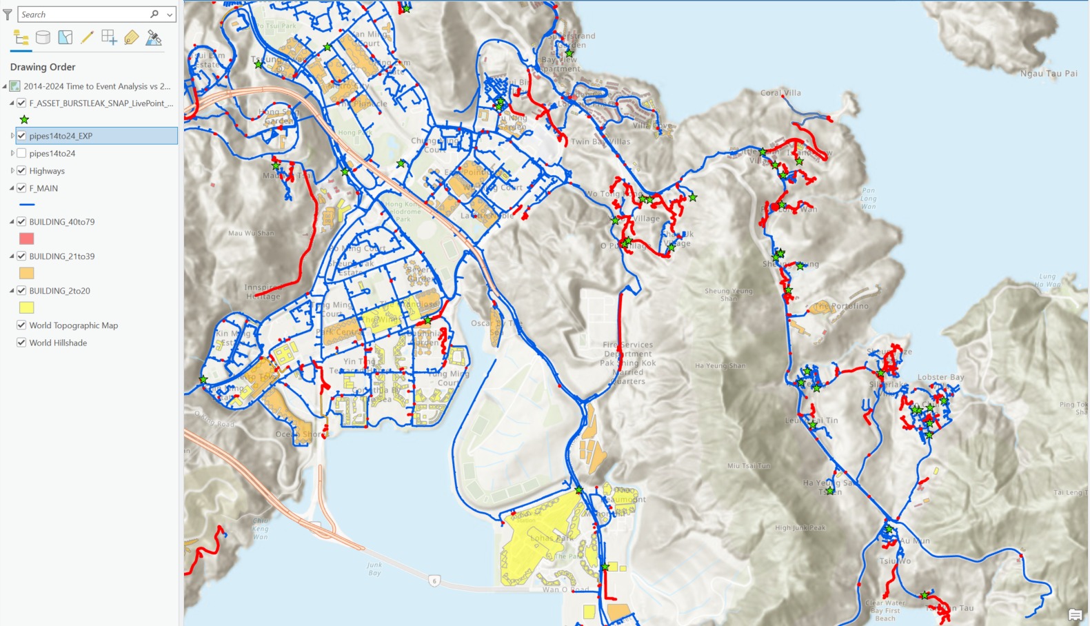
Pipe burst-leak network analysis Pipe burst-leak analysis

Spatial Analysis

Overlay, proximity, network, and terrain modelling.

08 / CONTACT

Say hello.

Let's connect.
Want a live demo of the agent stack? DM me.
Whether it's a geospatial agent idea, a collaboration, or just coffee chat and sharing ideas — I'd love to talk.